Relentless Rain Triggers More Than 80 UK Flood Warnings as Wet Spell Intensifies
LONDON, 7 February 2026
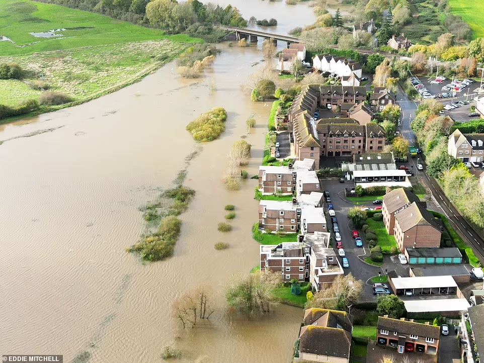
The United Kingdom is facing yet another spell of severe wet weather, with more than 80 flood warnings and over 250 flood alerts currently in force across England and Wales, as persistent rainfall continues to saturate large parts of the country. The Environment Agency (EA) has issued 82 flood warnings—indicating that flooding is expected—primarily across the South West and the Midlands. In contrast, 253 flood alerts remain active, signalling that flooding is possible from North Yorkshire to Cornwall and from the Welsh borders to Norfolk.
Natural Resources Wales has also placed 11 flood alerts across the border, adding to the widespread concerns as river levels rise and ground conditions worsen. Warwickshire Fire and Rescue Service warned that water levels in the River Dene have “risen to a state where flooding is imminent,” underscoring the seriousness of the situation.
A Nation Drenched: Rainfall Every Day of the Year So Far
Meteorologists report that the South West of England and South Wales have experienced rainfall every single day of 2026. According to the Met Office, both regions recorded 50% more rainfall than usual in January, while the South East received nearly a third of its average February rainfall within the first three days of the month.
Cornwall endured its wettest January on record, and other parts of the British Isles have seen similarly extreme conditions. Aberdeen, for example, recorded nearly two weeks without sunshine and has already exceeded its typical monthly rainfall total for February.
Meteorologists attribute the persistent downpours to a meandering jet stream that has created a “blocked pattern,” trapping the UK beneath successive low‑pressure systems. At the same time, Scandinavia remains under stable high pressure. This unusual atmospheric configuration has funnelled repeated bands of rain across the southern parts of the UK.
Weekend Weather Outlook: More Showers, Brief Bright Spells, and Renewed Storm Risk
Forecasters predict further blustery showers across the South West and heavy downpours in South Wales on Saturday, with a brief mix of sunshine and showers expected on Sunday. However, the respite will be short‑lived, as more wet and windy weather is forecast to sweep in from the west early next week.
The EA notes that flood warnings are typically issued 30 minutes to two hours before expected flooding, depending on river levels, rainfall intensity, and tidal conditions. With ground already saturated, even moderate rainfall could trigger rapid surface‑water flooding in vulnerable areas.
Communities on Alert as Travel Disruption and Property Risks Increase
Floodwater has already covered roads in parts of Hampshire, and emergency services across multiple counties are urging residents to remain vigilant. The combination of swollen rivers, saturated soil, and ongoing rainfall raises the risk of travel disruption, property damage, and hazardous driving conditions.
Authorities continue to advise the public to monitor official flood maps and weather updates, avoid walking or driving through floodwater, and prepare emergency plans where necessary.
A Winter Without Pause
With the UK now experiencing its 37th consecutive day of rain in some regions, public frustration has grown. Social media users have described the weather as “relentlessly depressing,” while meteorologists acknowledge that the prolonged wet spell is unusual even by British standards.
As the country braces for yet more rainfall, experts warn that the combination of saturated ground and incoming weather systems could prolong the risk of flooding well into next week.


